
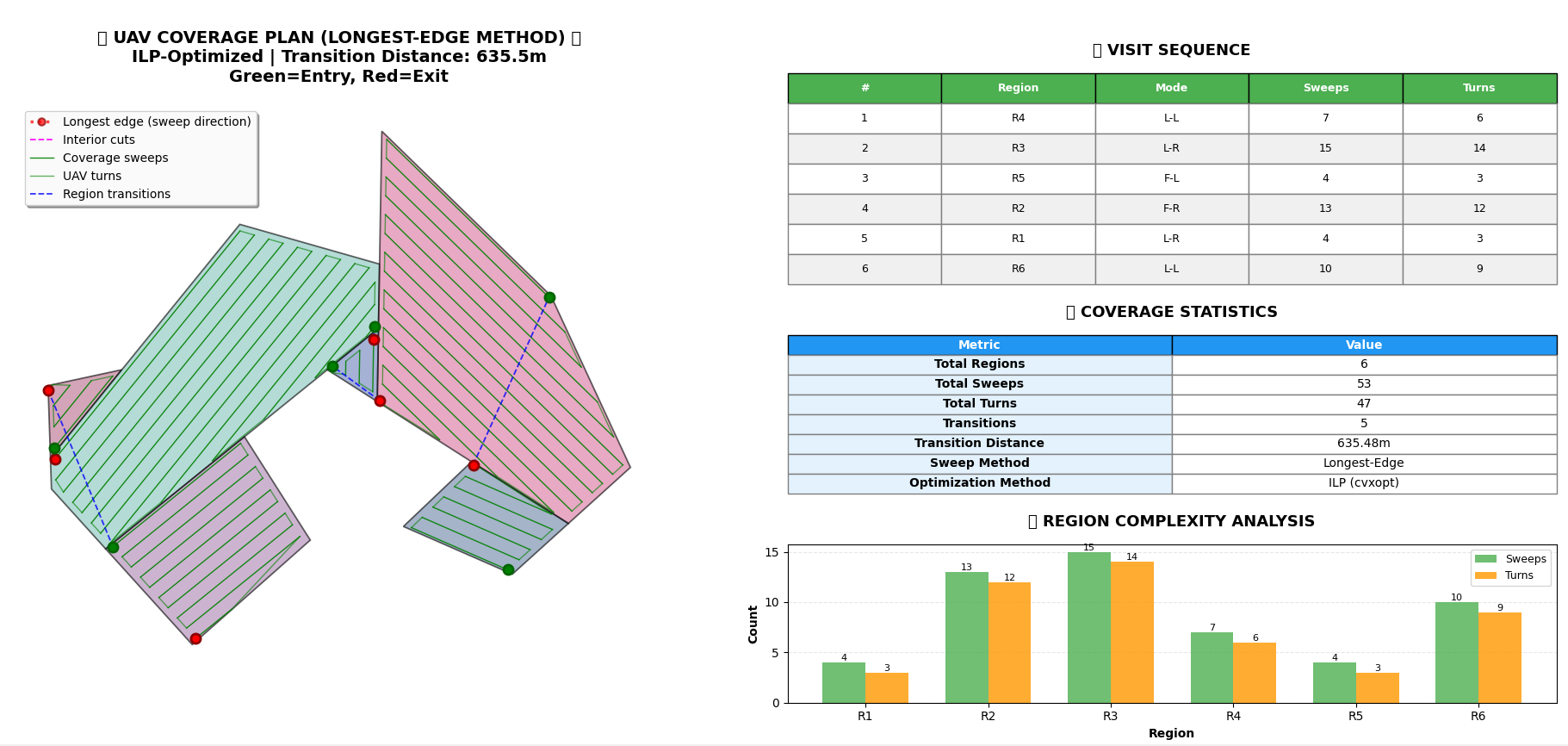
The project focused on developing a method to optimize drone utilization for aerial rice seeding, particularly on complex and concave terrains. The core of this work is built upon three pillars:
- Geometric Decomposition: Transforming concave surfaces into convex sub-regions to simplify coverage operations.
- Coverage Path Planning: Defining flight plans that guarantee complete coverage while minimizing overlaps and unseeded gaps.
- Optimization via Integer Linear Programming (ILP): Calculating the optimal traversal order of sub-regions to reduce unnecessary distances and energy-intensive turns, while simultaneously improving the consistency of seed distribution.
In summary, the project aims to make aerial seeding more efficient, less energy-consuming, and better adapted to irregular field shapes by combining mathematical modeling with algorithmic optimization.